Climate and Location
Located on the southern end of the Nicoya Peninsula, Santa Teresa is a short drive away from Montezuma and a short ferry across the bay from Jaco. While Santa Teresa itself is one small beach town, the are known as Santa Teresa usually encompasses a long stretch of beach communities, including nearby Mal Pais, Playa Carmen, and Playa Hermosa, among others. Just on the border of Mal Pais (at the furthest end of Santa Teresa) lies the Cabo Blanco National Park.
Climate
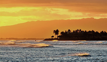
Like the rest of the Nicoya Peninsula, Santa Teresa has a distinct rainy and dry season. From mid November until April rainfall ceases and the roads can become dry and dusty. Most people driving down the main dirt road on ATVs and motorbikes wear protective eyewear and bandanas during the particularly dry months of March and April. During this time the days are consistently sunny with gorgeous sunsets in the evening. In the rainy season, it rains typically in the afternoon or evening and the jungle comes to life. September and October are the rainiest months and some businesses close during this time.
Copyright © 2014 KRAIN Costa Rica Limitada, All rights reserved.


